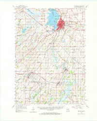
1955 Map of Beaver Dam
USGS Topo · Published 1967About this map
The city of Beaver Dam serves as the focal point for this mid-century survey, situated along the southeastern shores of Beaverdam Lake. The landscape is a mix of agricultural progress and small-town industry, where the Chicago Milwaukee St Paul and Pacific railroad intersects with local landmarks like the Beaver Dam Airport and the Drive-in Theater. The map reveals a dense network of country education, noting numerous schoolhouses such as Harrison Sch and Jackson Sch, including several already marked as abandoned by the 1950s.
Find a feature on this map
84 named features on this map. Tap any name to fly to it.
Don’t see what you’re looking for? This feature index may not catch every label — zoom into the map to look around manually.
Map Details
Editions of this 1955 Beaver Dam Map
2 editions found

Other maps of this area

1890 · Sun Prairie
USGS Topo · 1:62,500

1891 · Waterloo
USGS Topo · 1:62,500

1892 · Watertown
USGS Topo · 1:62,500

1894 · Waterloo
USGS Topo · 1:62,500

1894 · Watertown
USGS Topo · 1:62,500

1896 · Sun Prairie
USGS Topo · 1:62,500

1905 · Sun Prairie
USGS Topo · 1:62,500

1907 · Sun Prairie
USGS Topo · 1:62,500

1910 · Waterloo
USGS Topo · 1:62,500

1955 · Randolph
USGS Topo · 1:62,500