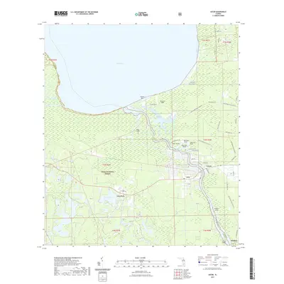
2021 Map of Astor
USGS Topo · Published 2021About this map
Lake George dominates the northern horizon of this landscape, its waters meeting the Saint Johns River at the Volusia Bar. The river serves as a central artery, winding past the settlements of Astor and Volusia while defining the border between Lake and Volusia counties. To the west, the protected reaches of the Ocala National Forest encompass a network of smaller water bodies such as Schimmerhorn Lake and Gobbler Lake.
Find a feature on this map
57 named features on this map. Tap any name to fly to it.
Don’t see what you’re looking for? This feature index may not catch every label — zoom into the map to look around manually.
Map Details
Editions of this 2021 Astor Map
This is the sole edition of this map. No revisions or reprints were ever made.
Other maps of this area

1954 · Daytona Beach
USGS Topo · 1:250,000

1958 · Daytona Beach
USGS Topo · 1:250,000

1962 · Lake Woodruff
USGS Topo · 1:24,000

1964 · Daytona Beach
USGS Topo · 1:250,000

1970 · Welaka SE
USGS Topo · 1:24,000

1970 · Seville
USGS Topo · 1:24,000

1970 · Salt Springs
USGS Topo · 1:24,000

1970 · Pierson
USGS Topo · 1:24,000

1972 · Juniper Springs
USGS Topo · 1:24,000
1972 · Farles Lake
USGS Topo · 1:24,000