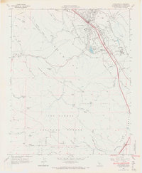
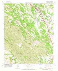
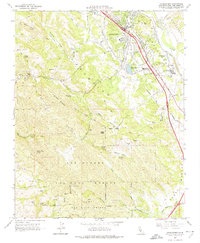
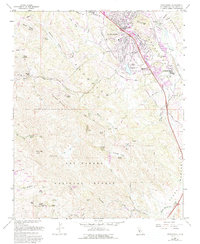
1965 Map of Atascadero
USGS Topo · Published 1966About this map
Atascadero serves as the focal point of this mid-1960s survey, illustrating a community defined by its proximity to the Salinas River and the Southern Pacific rail corridor. The map details a landscape transitioning from the urban core of the town to the protected wilderness of the Los Padres National Forest in the west. Local infrastructure is prominently featured, including the Atascadero State Hospital and municipal sites like Sewage Disposal Ponds.
Find a feature on this map
63 named features on this map. Tap any name to fly to it.
Don’t see what you’re looking for? This feature index may not catch every label — zoom into the map to look around manually.
Map Details
Editions of this 1965 Atascadero Map
4 editions found
Other maps of this area

1897 · San Luis Obispo
USGS Topo · 1:62,500

1897 · Cayucos
USGS Topo · 1:62,500

1900 · San Luis
USGS Topo · 1:125,000

1919 · Paso Robles
USGS Topo · 1:62,500

1919 · Adelaida
USGS Topo · 1:62,500

1932 · Adelaida
USGS Topo · 1:62,500

1937 · Cayucos
USGS Topo · 1:62,500

1942 · Adelaida
USGS Topo · 1:62,500

1942 · San Luis Obispo
USGS Topo · 1:62,500

1943 · Paso Robles
USGS Topo · 1:62,500