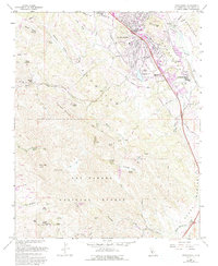
1965 Map of Atascadero
USGS Topo · Published 1994About this map
Atascadero serves as the focal point for this mid-1960s study, displaying a transition from the structured street grid of the town center to the sprawling foothills of the Los Padres National Forest. The map captures the significant presence of the Atascadero State Hospital and the nearby Atascadero Lake, which together with the Chalk Mountain Golf Course illustrate the community's mid-century institutional and recreational infrastructure. Transportation corridors like El Camino Real and the Southern Pacific railroad line track alongside the Salinas River, defining the valley's industrial and commuter flow.
Find a feature on this map
50 named features on this map. Tap any name to fly to it.
Don’t see what you’re looking for? This feature index may not catch every label — zoom into the map to look around manually.
Map Details
Editions of this 1965 Atascadero Map
4 editions found
Other maps of this area

1897 · San Luis Obispo
USGS Topo · 1:62,500

1897 · Cayucos
USGS Topo · 1:62,500

1900 · San Luis
USGS Topo · 1:125,000

1919 · Paso Robles
USGS Topo · 1:62,500

1919 · Adelaida
USGS Topo · 1:62,500

1932 · Adelaida
USGS Topo · 1:62,500

1937 · Cayucos
USGS Topo · 1:62,500

1942 · Adelaida
USGS Topo · 1:62,500

1942 · San Luis Obispo
USGS Topo · 1:62,500

1943 · Paso Robles
USGS Topo · 1:62,500