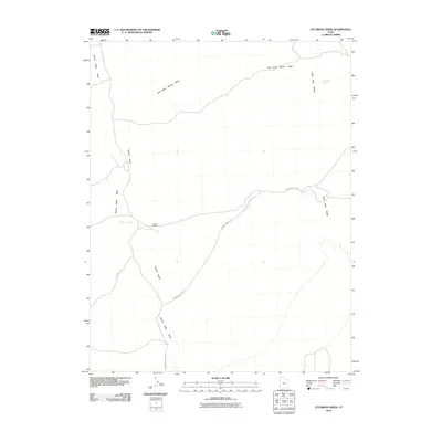
2010 Map of Atchison Creek
USGS Topo · Published 2010About this map
O'Grain Ranch stands as a focal point of human activity in this isolated reach of Iron County, situated near the intersection of the ephemeral Atchison Creek and the long drainages of Hamlin Valley Wash. The landscape is dominated by the high topography of the Indian Peak Range to the east, which sheds seasonal runoff into Salt Cabin Spring Wash and Salt Cabin Spring. This 2010 survey illustrates the fundamental reliance on water sources and road access in the high desert, centered on the corridor of Hamblin Valley Rd. The sparse infrastructure reveals a classic Western pattern where ranching outposts are positioned strategically between mountain ranges and valley washes to capture rare water resources in a challenging environment.
Find a feature on this map
7 named features on this map. Tap any name to fly to it.
Don’t see what you’re looking for? This feature index may not catch every label — zoom into the map to look around manually.
Map Details
Editions of this 2010 Atchison Creek Map
This is the sole edition of this map. No revisions or reprints were ever made.
Other maps of this area

1953 · Richfield
USGS Topo · 1:250,000

1956 · Lund
USGS Topo · 1:250,000

1958 · Richfield
USGS Topo · 1:250,000

1960 · Lund
USGS Topo · 1:250,000

1971 · Pinto Spring
USGS Topo · 1:24,000

1971 · Steamboat Mtn SW
USGS Topo · 1:24,000

1971 · Atchison Creek
USGS Topo · 1:24,000

1971 · Steamboat Mtn
USGS Topo · 1:24,000

1972 · Gleason Basin
USGS Topo · 1:24,000

1972 · White Rock Peak
USGS Topo · 1:24,000