
1972 Map of White Rock Peak
USGS Topo · Published 1974About this map
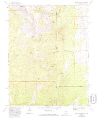
White Rock Mountains dominate this high-desert landscape on the Nevada-Utah border, centered on the prominent White Rock Peak. The area is characterized by a network of seasonal washes and isolated water sources that historically sustained local livestock and small-scale operations. Evidence of high-country habitation is visible in the presence of several primitive shelters, including Scotty's Cabin, White Rock Cabin Springs, and Log Cabin Spring.
Find a feature on this map
41 named features on this map. Tap any name to fly to it.
Don’t see what you’re looking for? This feature index may not catch every label — zoom into the map to look around manually.
Map Details
Editions of this 1972 White Rock Peak Map
2 editions found
Other maps of this area

1953 · Richfield
USGS Topo · 1:250,000

1956 · Lund
USGS Topo · 1:250,000

1958 · Richfield
USGS Topo · 1:250,000

1960 · Lund
USGS Topo · 1:250,000

1971 · Steamboat Mtn SW
USGS Topo · 1:24,000

1971 · Atchison Creek
USGS Topo · 1:24,000

1972 · Gleason Basin
USGS Topo · 1:24,000
1972 · Rice Mountain
USGS Topo · 1:24,000

1972 · Buck Wash Well
USGS Topo · 1:24,000
1972 · Eagle Valley Reservoir
USGS Topo · 1:24,000