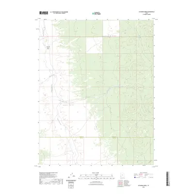
2023 Map of Atchison Creek
USGS Topo · Published 2023About this map
Indian Peak Range defines the high eastern terrain of this 2023 survey, while the wide expanse of Hamlin Valley occupies the west. This arid landscape is shaped by ephemeral drainages that descend from the peaks, notably Atchison Creek and Willow Creek, which eventually reach the north-south corridor of Hamlin Valley Wash. The map documents a sparsely populated region along the border of Beaver and Iron counties, where water remains the primary driver of geography. Small, isolated features like Salt Cabin Spring and its namesake Salt Cabin Spring Wash represent the vital water sources that have historically supported ranching and movement through this high desert environment.
Find a feature on this map
8 named features on this map. Tap any name to fly to it.
Don’t see what you’re looking for? This feature index may not catch every label — zoom into the map to look around manually.
Map Details
Editions of this 2023 Atchison Creek Map
This is the sole edition of this map. No revisions or reprints were ever made.
Other maps of this area

1953 · Richfield
USGS Topo · 1:250,000

1956 · Lund
USGS Topo · 1:250,000

1958 · Richfield
USGS Topo · 1:250,000

1960 · Lund
USGS Topo · 1:250,000

1971 · Pinto Spring
USGS Topo · 1:24,000

1971 · Steamboat Mtn SW
USGS Topo · 1:24,000

1971 · Atchison Creek
USGS Topo · 1:24,000

1971 · Steamboat Mtn
USGS Topo · 1:24,000

1972 · Gleason Basin
USGS Topo · 1:24,000

1972 · White Rock Peak
USGS Topo · 1:24,000