
1971 Map of Atchison Creek
USGS Topo · Published 1974About this map
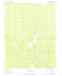
The Indian Peak Range dominates the eastern landscape of this 1971 survey, casting its shadows over the expansive Hamlin Valley to the west. This high-desert terrain is defined by a seasonal water network, where drainage from Atchison Creek and Willow Creek feeds into the broad Hamlin Valley Wash. Settlement is sparse in this portion of the Great Basin, centered primarily at the O'Grain Ranch, which is served by a nearby Landing Strip. The presence of several Prospects and the Usmm 264 mineral monument suggests a history of resource exploration along the mountain flanks. A network of primitive ways, including a Jeep Trail, provides the primary access between remote watering points like Salt Cabin Spring and the boundary line separating Beaver and Iron counties.
Find a feature on this map
14 named features on this map. Tap any name to fly to it.
Don’t see what you’re looking for? This feature index may not catch every label — zoom into the map to look around manually.
Map Details
Editions of this 1971 Atchison Creek Map
This is the sole edition of this map. No revisions or reprints were ever made.
Other maps of this area

1953 · Richfield
USGS Topo · 1:250,000

1956 · Lund
USGS Topo · 1:250,000

1958 · Richfield
USGS Topo · 1:250,000

1960 · Lund
USGS Topo · 1:250,000

1971 · Pinto Spring
USGS Topo · 1:24,000

1971 · Steamboat Mtn SW
USGS Topo · 1:24,000

1971 · Steamboat Mtn
USGS Topo · 1:24,000

1972 · Gleason Basin
USGS Topo · 1:24,000

1972 · White Rock Peak
USGS Topo · 1:24,000
1972 · Rice Mountain
USGS Topo · 1:24,000