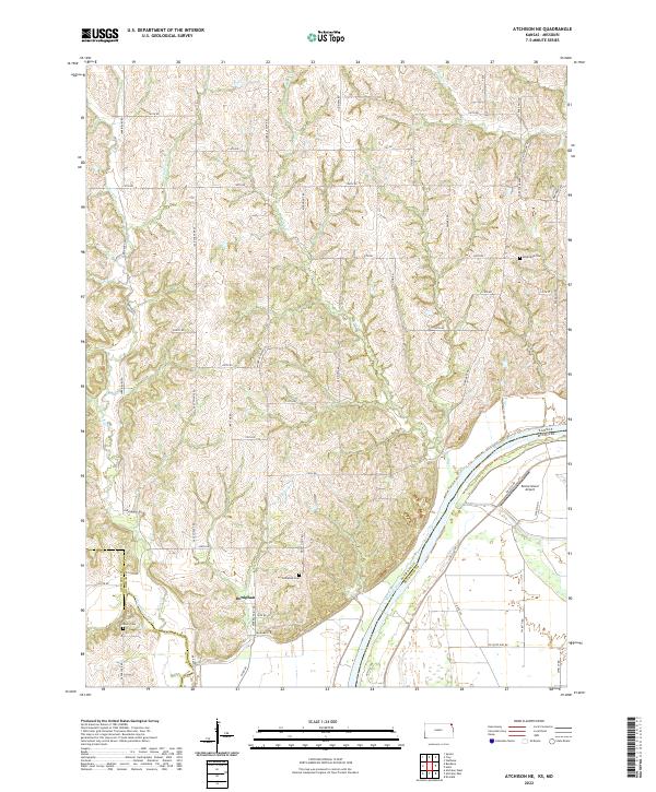
2022 Map of Atchison NE
USGS Topo · Published 2022About this map
The riverfront settlement of Doniphan sits prominently on the banks of the Missouri River in this detailed survey of the Kansas-Missouri border region. The landscape is defined by the sharp convergence of several waterways, including Independence Creek and Rock Creek, which cut through the terrain toward the massive river bend. Genealogists can find significant local history preserved at the Doniphan Cemetery and Myers Cemetery near the town, while Rosendale Cemetery serves the rural northern reaches of the quadrangle. On the Missouri side of the river, the presence of Booze Island and a nearby Airport highlights the differing land use patterns between the residential and agricultural Kansas bluffs and the lower, more industrial floodplain across the state line. A dense network of rural roads like Last Chance Road and Mineral Point Road connects the numerous family farms and homesteads scattered across the interior uplands.
Find a feature on this map
57 named features on this map. Tap any name to fly to it.
Don’t see what you’re looking for? This feature index may not catch every label — zoom into the map to look around manually.
Map Details
Editions of this 2022 Atchison NE Map
This is the sole edition of this map. No revisions or reprints were ever made.
Other maps of this area

1885 · Atchison
USGS Topo · 1:125,000

1888 · Atchison
USGS Topo · 1:125,000

1893 · Atchison
USGS Topo · 1:125,000

1924 · St. Joseph
USGS Topo · 1:62,500

1926 · Atchison
USGS Topo · 1:62,500

1926 · Saint Joseph
USGS Topo · 1:62,500

1926 · Oregon
USGS Topo · 1:62,500

1927 · Dearborn
USGS Topo · 1:62,500

1950 · Kansas City
USGS Topo · 1:250,000
1951 · De Kalb
USGS Topo · 1:24,000