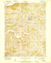
1951 Map of De Kalb
USGS Topo · Published 1951About this map
DeKalb stands as the primary settlement in this post-war landscape, where the rural character of Missouri's northwest is defined by a dense network of one-room schoolhouses and small family cemeteries. The terrain is deeply carved by water systems like Sugar Creek and Contrary Creek, which navigate through the townships of Wayne, Bloomington, and Marshall. Genealogists will find significant detail in the placement of numerous educational sites such as Lewis School, Sampson School, and Forest Valley School, which served the dispersed farming community.
Find a feature on this map
38 named features on this map. Tap any name to fly to it.
Don’t see what you’re looking for? This feature index may not catch every label — zoom into the map to look around manually.
Map Details
Editions of this 1951 De Kalb Map
2 editions found
Other maps of this area

1885 · Atchison
USGS Topo · 1:125,000

1886 · Oskaloosa
USGS Topo · 1:125,000

1888 · Oskaloosa
USGS Topo · 1:125,000

1888 · Atchison
USGS Topo · 1:125,000

1890 · Kansas City
USGS Topo · 1:125,000

1893 · Atchison
USGS Topo · 1:125,000

1894 · Kansas City
USGS Topo · 1:125,000

1894 · Oskaloosa
USGS Topo · 1:125,000

1910 · Leavenworth
USGS Topo · 1:62,500

1926 · Atchison
USGS Topo · 1:62,500