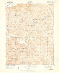
1951 Map of De Kalb
USGS Topo · Published 1951About this map
The settlement of DeKalb serves as the primary hub of this Missouri landscape, situated where the hills of Bloomington and Crawford townships meet. During the late 1940s, this region remained characterized by a dense network of rural schoolhouses and small cemeteries, reflecting a distributed agrarian society before mid-century school consolidations. Distinctive names like Sleepy Hollow Sch, Valley Chapel Sch, and Forest Valley School are scattered across the terrain, connected by winding country roads that follow the ridges above the Big Sugar Creek valley. To the northwest, the influence of the regional rail network is evident as the C B & Q and C R I & P lines cut through the corner of the map near the Missouri River bottomlands. The map also delineates the Buchanan Co and Platte Co boundary, showing the transition between these two northern Missouri counties.
Find a feature on this map
29 named features on this map. Tap any name to fly to it.
Don’t see what you’re looking for? This feature index may not catch every label — zoom into the map to look around manually.
Map Details
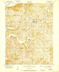
Editions of this 1951 De Kalb Map
2 editions found
Other maps of this area

1885 · Atchison
USGS Topo · 1:125,000

1886 · Oskaloosa
USGS Topo · 1:125,000

1888 · Oskaloosa
USGS Topo · 1:125,000

1888 · Atchison
USGS Topo · 1:125,000

1890 · Kansas City
USGS Topo · 1:125,000

1893 · Atchison
USGS Topo · 1:125,000

1894 · Kansas City
USGS Topo · 1:125,000

1894 · Oskaloosa
USGS Topo · 1:125,000

1910 · Leavenworth
USGS Topo · 1:62,500

1926 · Atchison
USGS Topo · 1:62,500