1959 Map of Atchison NE
USGS Topo · Published 1973About this map
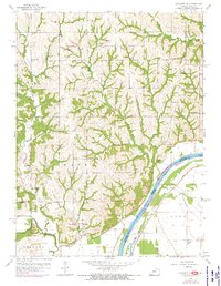
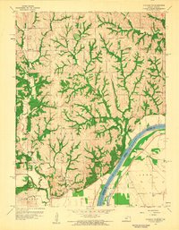
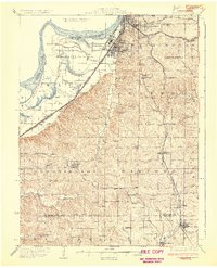
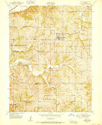
Doniphan sits above the Missouri River in this survey of northeastern Kansas and northwestern Missouri, updated in the early 1970s. The landscape is characterized by the intricate drainage systems of Rock Creek, Cottonwood Creek, and Independence Creek, which carve through the townships of Wayne, Marion, and Center. This map captures a rural educational and religious network just as many small country schools were consolidating, showing several such structures including Brenner Sch, Oak Grove Sch, and Cordonier Sch. Genealogists will find significant detail in the placement of local burial grounds like Doniphan Cem and Rosedale Cem. Along the river’s edge, the map documents industrial activity through several noted Quarries and a prominent Quarry near the shoreline, alongside the marshy terrain of the area simply labeled Lake.
Find a feature on this map
29 named features on this map. Tap any name to fly to it.
Don’t see what you’re looking for? This feature index may not catch every label — zoom into the map to look around manually.
Map Details
Editions of this 1959 Atchison NE Map
2 editions found
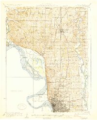
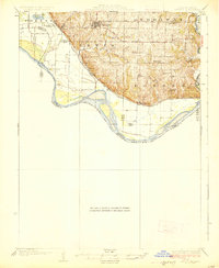
Other maps of this area

1885 · Atchison
USGS Topo · 1:125,000

1888 · Atchison
USGS Topo · 1:125,000

1893 · Atchison
USGS Topo · 1:125,000

1924 · St. Joseph
USGS Topo · 1:62,500

1926 · Atchison
USGS Topo · 1:62,500
1926 · Saint Joseph
USGS Topo · 1:62,500
1926 · Oregon
USGS Topo · 1:62,500
1927 · Dearborn
USGS Topo · 1:62,500

1950 · Kansas City
USGS Topo · 1:250,000
1951 · De Kalb
USGS Topo · 1:24,000