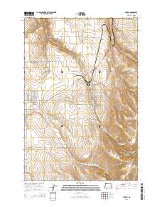
2014 Map of Athena
USGS Topo · Published 2014About this map
Athena and Weston serve as the primary hubs of this Umatilla County landscape, where the agricultural plains meet the rising slopes of Weston Mountain. This 2014 survey reveals a highly organized network of township and range boundaries, including sections of t4n r35e and t5n r35e, which dictate the local road grid. The transition from the wheat-growing flats to the timbered heights of Reed and Hawley Mountain is marked by steep canyons such as La Marr Gulch and Dry Hollow. Water management is central to this environment, evidenced by Poplar Springs Reservoir and the winding course of Wildhorse Creek. Local history and genealogy are preserved at the Weston Cemetery and the more secluded Kees Cemetery, while landmarks like Earthquake Spring point to the geological activity that shaped this Pacific Northwest terrain.
Find a feature on this map
97 named features on this map. Tap any name to fly to it.
Don’t see what you’re looking for? This feature index may not catch every label — zoom into the map to look around manually.
Map Details
Editions of this 2014 Athena Map
This is the sole edition of this map. No revisions or reprints were ever made.
Other maps of this area

1935 · Pendleton
USGS Topo · 1:125,000

1953 · Pendleton
USGS Topo · 1:250,000

1956 · Pendleton
USGS Topo · 1:250,000

1964 · Milton-Freewater
USGS Topo · 1:24,000

1964 · Thorn Hollow
USGS Topo · 1:24,000

1964 · Athena
USGS Topo · 1:24,000

1964 · Bowlus Hill
USGS Topo · 1:24,000

1964 · Weston Mountain
USGS Topo · 1:24,000

1964 · Gibbon
USGS Topo · 1:24,000
1966 · Adams
USGS Topo · 1:24,000