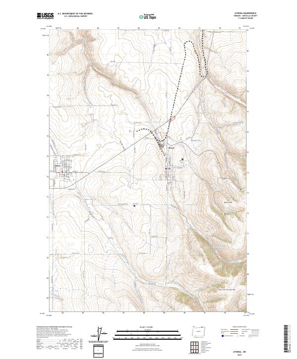
2023 Map of Athena
USGS Topo · Published 2023About this map
Athena and Weston serve as the primary hubs in this agricultural and highland landscape of Umatilla County. The transition from the flat, cultivated fields surrounding Wildhorse Creek to the steep rises of Weston Mtn and Reed and Hawley Mtn dominates the eastern half of the map. This area is heavily defined by its drainage systems, including Pine Creek, Dry Creek, and the curiously named Earthquake Spring.
Find a feature on this map
69 named features on this map. Tap any name to fly to it.
Don’t see what you’re looking for? This feature index may not catch every label — zoom into the map to look around manually.
Map Details
Editions of this 2023 Athena Map
This is the sole edition of this map. No revisions or reprints were ever made.
Other maps of this area

1935 · Pendleton
USGS Topo · 1:125,000

1953 · Pendleton
USGS Topo · 1:250,000

1956 · Pendleton
USGS Topo · 1:250,000

1964 · Milton-Freewater
USGS Topo · 1:24,000

1964 · Thorn Hollow
USGS Topo · 1:24,000

1964 · Athena
USGS Topo · 1:24,000

1964 · Bowlus Hill
USGS Topo · 1:24,000

1964 · Weston Mountain
USGS Topo · 1:24,000

1964 · Gibbon
USGS Topo · 1:24,000
1966 · Adams
USGS Topo · 1:24,000