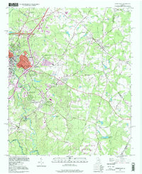
1998 Map of Athens East
USGS Topo · Published 1999About this map
Athens and the surrounding Clarke County landscape are defined by the convergence of the Middle Oconee River and the North Oconee River, creating a terrain deeply etched by waterways like Cedar Creek and Shoals Creek. The university's presence is prominent through specialized facilities such as the University of Georgia School of Forestry and the University of Georgia Poultry Research Center, reflecting the agricultural and academic character of the region during the late twentieth century.
Find a feature on this map
69 named features on this map. Tap any name to fly to it.
Don’t see what you’re looking for? This feature index may not catch every label — zoom into the map to look around manually.
Map Details
Editions of this 1998 Athens East Map
This is the sole edition of this map. No revisions or reprints were ever made.
Other maps of this area

1891 · Carnesville
USGS Topo · 1:125,000

1953 · Athens
USGS Topo · 1:250,000

1954 · Greenville
USGS Topo · 1:250,000

1958 · Greenville
USGS Topo · 1:250,000

1958 · Athens
USGS Topo · 1:250,000

1958 · Danielsville
USGS Topo · 1:62,500

1959 · Athens
USGS Topo · 1:250,000

1963 · Athens
USGS Topo · 1:250,000

1964 · Athens West
USGS Topo · 1:24,000

1964 · Barnett Shoals
USGS Topo · 1:24,000