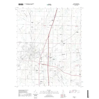
2018 Map of Athens
USGS Topo · Published 2018About this map
Athens serves as the focal point of this northern Alabama survey, where the campus of Athens State Univ stands near the center of a rapidly evolving landscape. The town is surrounded by a dense network of suburban developments such as Brookwood Forest, Pinedale Acres, and Oakdale Acres, reflecting the modern expansion of the county seat. Beyond the residential clusters, the terrain transitions into the Interior Low Plateau, marked by numerous family-named landmarks and water bodies like Swan Creek and Braly Lake. Significant sites for genealogical research include the historic Slave Cem and Cambridge Church Cem, which offer physical links to the area's diverse heritage. The drainage patterns of Piney Creek and Muddy Creek define the agricultural surroundings, while smaller settlements like Sardis Springs and Piney Chapel remain connected by a web of county roads and historic corridors.
Find a feature on this map
221 named features on this map. Tap any name to fly to it.
Don’t see what you’re looking for? This feature index may not catch every label — zoom into the map to look around manually.
Map Details
Editions of this 2018 Athens Map
This is the sole edition of this map. No revisions or reprints were ever made.
Other maps of this area

1888 · Huntsville
USGS Topo · 1:125,000

1892 · Huntsville
USGS Topo · 1:125,000

1935 · Athens
USGS Topo · 1:24,000

1936 · Capshaw
USGS Topo · 1:24,000

1936 · Stewart Cross Roads
USGS Topo · 1:24,000

1936 · Elkmont
USGS Topo · 1:24,000

1936 · Ripley
USGS Topo · 1:24,000

1936 · Ardmore
USGS Topo · 1:24,000

1936 · Tanner
USGS Topo · 1:24,000

1936 · Greenbrier
USGS Topo · 1:24,000