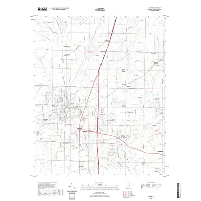
2020 Map of Athens
USGS Topo · Published 2020About this map
Athens serves as the focal point of this Limestone County landscape, where the historic core is anchored by the Limestone County Courthouse and Athens State University. The town's growth is evident in its surrounding residential developments such as Bonnie Doone, Oakdale Acres, and Pinedale Acres. For genealogists, this survey is particularly dense with burial grounds, ranging from the central Athens City Cem and Old City Cem to the notable Slave Cem located to the northeast near Piney Cr. The map reveals a transition from the structured urban streets of the county seat to the rural agricultural patterns of the Interior Low Plateau. Significant water features like Braly Lake and the meandering Swan Creek define the local drainage, while outlying settlements like French Mill and Sardis Springs mark the intersection of long-established country roads.
Find a feature on this map
88 named features on this map. Tap any name to fly to it.
Don’t see what you’re looking for? This feature index may not catch every label — zoom into the map to look around manually.
Map Details
Editions of this 2020 Athens Map
This is the sole edition of this map. No revisions or reprints were ever made.
Other maps of this area

1888 · Huntsville
USGS Topo · 1:125,000

1892 · Huntsville
USGS Topo · 1:125,000

1935 · Athens
USGS Topo · 1:24,000

1936 · Capshaw
USGS Topo · 1:24,000

1936 · Stewart Cross Roads
USGS Topo · 1:24,000

1936 · Elkmont
USGS Topo · 1:24,000

1936 · Ripley
USGS Topo · 1:24,000

1936 · Ardmore
USGS Topo · 1:24,000

1936 · Tanner
USGS Topo · 1:24,000

1936 · Greenbrier
USGS Topo · 1:24,000