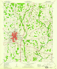
1958 Map of Athens
USGS Topo · Published 1959About this map
Athens serves as the hub of this 1950s agricultural and educational landscape, centered at the intersection of the Bee Line Highway and Lee Highway. The city's core is densely packed with civic institutions including the Courthouse, City Hall, and the Armory, while its educational character is defined by Athens College and the Athens Bible Sch. Outside the city limits, the terrain is shaped by the Louisville and Nashville railroad and a network of rural communities such as Piney Chapel, Sardis Springs, and Wigginsville.
Find a feature on this map
60 named features on this map. Tap any name to fly to it.
Don’t see what you’re looking for? This feature index may not catch every label — zoom into the map to look around manually.
Map Details
Editions of this 1958 Athens Map
This is the sole edition of this map. No revisions or reprints were ever made.
Other maps of this area

1888 · Huntsville
USGS Topo · 1:125,000

1892 · Huntsville
USGS Topo · 1:125,000

1935 · Athens
USGS Topo · 1:24,000

1936 · Capshaw
USGS Topo · 1:24,000

1936 · Stewart Cross Roads
USGS Topo · 1:24,000

1936 · Elkmont
USGS Topo · 1:24,000

1936 · Ripley
USGS Topo · 1:24,000

1936 · Ardmore
USGS Topo · 1:24,000

1936 · Tanner
USGS Topo · 1:24,000

1936 · Greenbrier
USGS Topo · 1:24,000