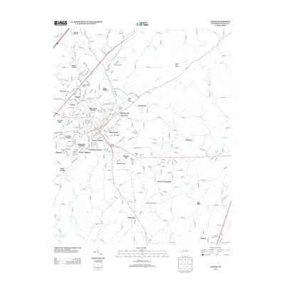
2013 Map of Athens
USGS Topo · Published 2013About this map
Oostanaula Cr winds through the heart of this East Tennessee landscape, anchoring a network of residential additions and historically rooted settlements. The urban fabric of Athens is represented by numerous named developments, including Bohannon Addition, Lockmiller Addition, and Avalon Heights, reflecting mid-to-late 20th-century growth patterns. To the north and south, the character shifts toward rural infrastructure, marked by the McMinn County Airport and the Norfolk Southern railway corridor.
Find a feature on this map
308 named features on this map. Tap any name to fly to it.
Don’t see what you’re looking for? This feature index may not catch every label — zoom into the map to look around manually.
Map Details
Editions of this 2013 Athens Map
This is the sole edition of this map. No revisions or reprints were ever made.
Other maps of this area

1886 · Cleveland
USGS Topo · 1:125,000

1887 · Kingston
USGS Topo · 1:125,000

1891 · Kingston
USGS Topo · 1:125,000

1892 · Cleveland
USGS Topo · 1:125,000

1893 · Murphy
USGS Topo · 1:125,000

1893 · Kingston
USGS Topo · 1:125,000

1895 · Cleveland
USGS Topo · 1:125,000

1895 · Loudon
USGS Topo · 1:125,000

1901 · Cleveland
USGS Topo · 1:125,000

1914 · Murphy
USGS Topo · 1:125,000