2024 Map of Athens West
USGS Topo · Published 2024About this map
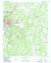
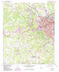
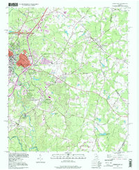
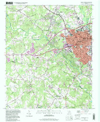
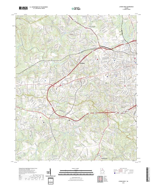
The city of Athens serves as the central hub of this Georgia landscape, situated where the Middle Oconee River and the North Oconee River diverge. The map reveals the sprawling expansion of the western suburbs and institutional landmarks, including the University of Georgia Health Sciences Campus and the Christian College of Georgia. To the south and west, smaller communities like Princeton, Watkinsville, and Eastville define the periphery, interspersed with a complex system of waterways and reservoirs such as Lake Wildwood and T M Tillman Lake. Genealogists will find significant value in the documentation of several local burial grounds, including Evergreen Memorial Park Cem, Brooklyn Cem, Mars Hill Cem, and Robinson Cem. The transition from the urban grid of the city to the unincorporated reaches of Oconee Heights illustrates the region's contemporary development patterns across the Clarke and Oconee county lines.
Find a feature on this map
390 named features on this map. Tap any name to fly to it.
Don’t see what you’re looking for? This feature index may not catch every label — zoom into the map to look around manually.
Map Details
Editions of this 2024 Athens West Map
This is the sole edition of this map. No revisions or reprints were ever made.
Historical Maps of Jefferson Valley Through Time
6 maps found