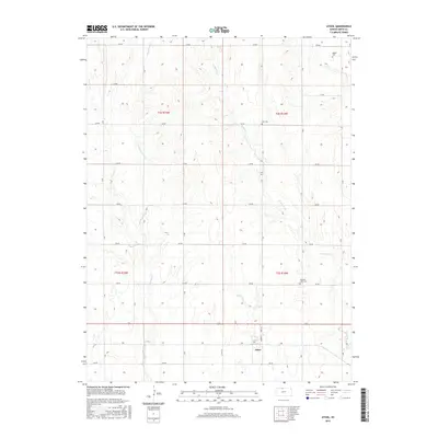
2015 Map of Athol
USGS Topo · Published 2015About this map
Athol serves as the primary community anchor for this Smith County landscape, which is defined by a rhythmic grid of rural roads and drainage networks. The topography is shaped by three significant watercourses: W Beaver Cr, Cottonwood Cr, and E Cedar Cr, which cut through the agricultural sections. For those researching family history or regional heritage, several burial grounds are scattered across the quadrangle, including Meade Cem in the north and Zion Cem further south. The map illustrates a highly organized township and range system, where roads like Co Rd 515 and 150 Rd facilitate travel between the varied creek basins. The layout of Athol itself remains concentrated near the intersection of Cedar St and Pine St, representing a quintessential High Plains settlement pattern.
Find a feature on this map
28 named features on this map. Tap any name to fly to it.
Don’t see what you’re looking for? This feature index may not catch every label — zoom into the map to look around manually.
Map Details
Editions of this 2015 Athol Map
This is the sole edition of this map. No revisions or reprints were ever made.
Other maps of this area

1893 · Smith Center
USGS Topo · 1:125,000

1893 · Phillipsburg
USGS Topo · 1:125,000

1955 · Beloit
USGS Topo · 1:250,000

1959 · Beloit
USGS Topo · 1:250,000

1972 · Kirwin
USGS Topo · 1:24,000

1973 · Kensington
USGS Topo · 1:24,000

1973 · Athol
USGS Topo · 1:24,000

1973 · Kensington NE
USGS Topo · 1:24,000
1973 · Reamsville
USGS Topo · 1:24,000
1973 · Cedar
USGS Topo · 1:24,000