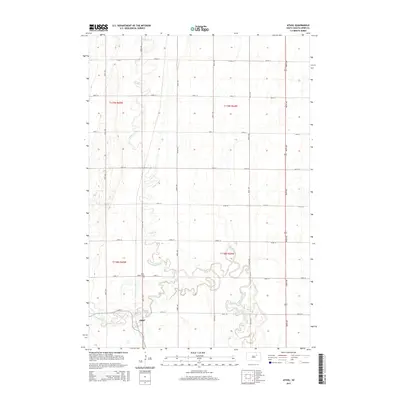
2015 Map of Athol
USGS Topo · Published 2015About this map
The settlement of Athol centers this portion of Spink County, situated within a landscape defined by the serpentine path of Snake Creek. The township is structured by a rigorous grid of section lines, including 382nd Ave and 164th St, which facilitate movement through this agricultural region. Near the southern bend of the creek, Saint Marys Cem serves as a significant landmark for local genealogy and history. The convergence of S Fork Snake Cr and the main branch of Snake Cr south of the town creates a complex drainage pattern, illustrating the water-dependent nature of early South Dakota settlement layouts. This survey provides a clear view of the rural infrastructure as it stood in the mid-2010s.
Find a feature on this map
24 named features on this map. Tap any name to fly to it.
Don’t see what you’re looking for? This feature index may not catch every label — zoom into the map to look around manually.
Map Details
Editions of this 2015 Athol Map
This is the sole edition of this map. No revisions or reprints were ever made.
Other maps of this area

1895 · Byron
USGS Topo · 1:125,000

1895 · Aberdeen
USGS Topo · 1:125,000

1899 · Northville
USGS Topo · 1:125,000

1899 · Redfield
USGS Topo · 1:125,000

1953 · Redfield North
USGS Topo · 1:24,000

1953 · Gallup
USGS Topo · 1:24,000

1953 · Ashton
USGS Topo · 1:24,000

1953 · Huron
USGS Topo · 1:250,000

1954 · Mellette
USGS Topo · 1:24,000

1954 · Aberdeen
USGS Topo · 1:250,000