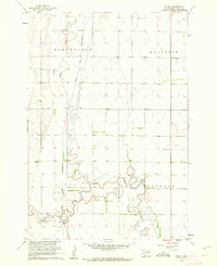
1960 Map of Athol
USGS Topo · Published 1962About this map
Snake Creek carves a winding path across this Spink County prairie landscape, its meandering loops and oxbows defining the local topography between the townships of Northville, Mellette, Athol, and Jefferson. The small settlement of Athol serves as a focal point near the southern edge of the sheet, situated along the Chicago and North Western railroad line. This rail corridor provided the vital link for local agriculture to reach broader markets during the mid-20th century.
Find a feature on this map
11 named features on this map. Tap any name to fly to it.
Don’t see what you’re looking for? This feature index may not catch every label — zoom into the map to look around manually.
Map Details
Editions of this 1960 Athol Map
This is the sole edition of this map. No revisions or reprints were ever made.
Other maps of this area

1895 · Byron
USGS Topo · 1:125,000

1895 · Aberdeen
USGS Topo · 1:125,000

1899 · Northville
USGS Topo · 1:125,000

1899 · Redfield
USGS Topo · 1:125,000

1953 · Redfield North
USGS Topo · 1:24,000

1953 · Gallup
USGS Topo · 1:24,000

1953 · Ashton
USGS Topo · 1:24,000

1953 · Huron
USGS Topo · 1:250,000

1954 · Mellette
USGS Topo · 1:24,000

1954 · Aberdeen
USGS Topo · 1:250,000