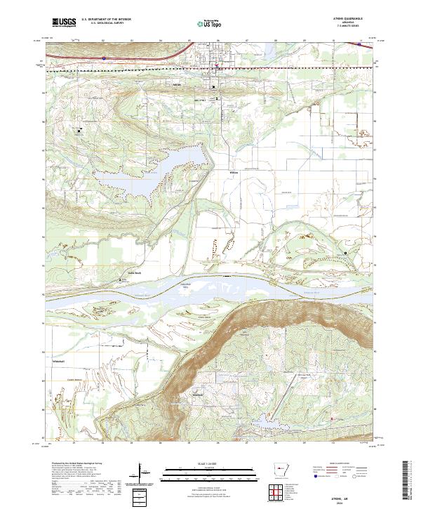
2024 Map of Atkins
USGS Topo · Published 2024About this map
Atkins serves as the primary hub on this Pope County landscape, situated just north of the Arkansas River and its wide floodplain. The terrain is defined by the contrast between the flat, productive soils of Carden Bottom and the steep elevation of Petit Jean Mountain to the south. This geographic divide is mirrored in the local transport history, seen in the crossing at Galla Rock Ferry and the proximity of the Petit Jean Park Airport near the southern boundary.
Find a feature on this map
78 named features on this map. Tap any name to fly to it.
Don’t see what you’re looking for? This feature index may not catch every label — zoom into the map to look around manually.
Map Details
Editions of this 2024 Atkins Map
This is the sole edition of this map. No revisions or reprints were ever made.
Other maps of this area

1888 · Dardanelle #4
USGS Topo · 1:62,500

1888 · Dardanelle #1
USGS Topo · 1:62,500

1889 · Morrilton No. 3
USGS Topo · 1:62,500

1890 · Dardanelle
USGS Topo · 1:125,000

1892 · Morrillton
USGS Topo · 1:125,000

1894 · Morrillton
USGS Topo · 1:125,000

1956 · Russellville
USGS Topo · 1:250,000

1961 · Perryville
USGS Topo · 1:24,000

1961 · Morrilton West
USGS Topo · 1:24,000

1961 · Adona
USGS Topo · 1:24,000