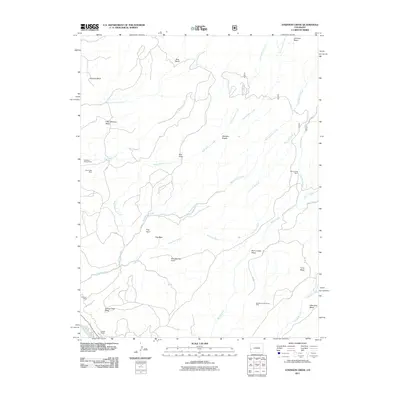
2011 Map of Atkinson Creek
USGS Topo · Published 2011About this map
Sunbeam Group Mines and the Movie Star Mine dominate the high ground of this Colorado quadrangle, illustrating the enduring legacy of resource extraction in the region. The landscape is defined by its drainage systems, where Big Atkinson Creek and Hog Park Wash carve through the sedimentary layers near Gypsum Bluff. In the southern portion of the sheet, the San Miguel River clips the corner, providing a vital water source in an otherwise arid plateau environment.
Find a feature on this map
39 named features on this map. Tap any name to fly to it.
Don’t see what you’re looking for? This feature index may not catch every label — zoom into the map to look around manually.
Map Details
Editions of this 2011 Atkinson Creek Map
This is the sole edition of this map. No revisions or reprints were ever made.
Other maps of this area

1916 · Paradox Valley
USGS Topo · 1:125,000

1922 · Paradox Valley
USGS Topo · 1:125,000

1948 · Uravan
USGS Topo · 1:24,000

1949 · Davis Mesa
USGS Topo · 1:24,000

1949 · Uravan
USGS Topo · 1:24,000

1949 · Atkinson Creek
USGS Topo · 1:24,000

1949 · Red Canyon
USGS Topo · 1:24,000

1949 · Calamity Mesa
USGS Topo · 1:24,000

1950 · Calamity Mesa
USGS Topo · 1:24,000

1950 · Atkinson Creek
USGS Topo · 1:24,000