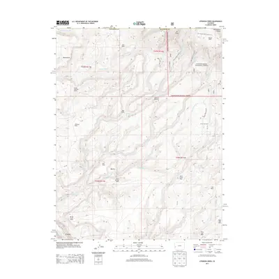
2013 Map of Atkinson Creek
USGS Topo · Published 2013About this map
Uravan sits along the San Miguel River at the southwestern edge of a landscape defined by deep drainages and high plateaus. This 2013 survey illustrates the complex topography of the Uncompahgre Plateau, where landforms like Gypsum Bluff, Atkinson Mesa, and Wild Cow Mesa are separated by seasonal washes such as Hog Park Wash and Spring Cr. Much of the eastern portion of the map is contained within the Uncompahgre National Forest, showing a network of specialized access routes like the Spring Creek Truck Trl and Little Johnson Trail 2617.0. The map documents the transition from the river valley to the high basins, including Johnson Basin and Blue Basin, reflecting the enduring cattle-ranching and forest-service management of this high-desert environment.
Find a feature on this map
54 named features on this map. Tap any name to fly to it.
Don’t see what you’re looking for? This feature index may not catch every label — zoom into the map to look around manually.
Map Details
Editions of this 2013 Atkinson Creek Map
This is the sole edition of this map. No revisions or reprints were ever made.
Other maps of this area

1916 · Paradox Valley
USGS Topo · 1:125,000

1922 · Paradox Valley
USGS Topo · 1:125,000

1948 · Uravan
USGS Topo · 1:24,000

1949 · Davis Mesa
USGS Topo · 1:24,000

1949 · Uravan
USGS Topo · 1:24,000

1949 · Atkinson Creek
USGS Topo · 1:24,000

1949 · Red Canyon
USGS Topo · 1:24,000

1949 · Calamity Mesa
USGS Topo · 1:24,000

1950 · Calamity Mesa
USGS Topo · 1:24,000

1950 · Atkinson Creek
USGS Topo · 1:24,000