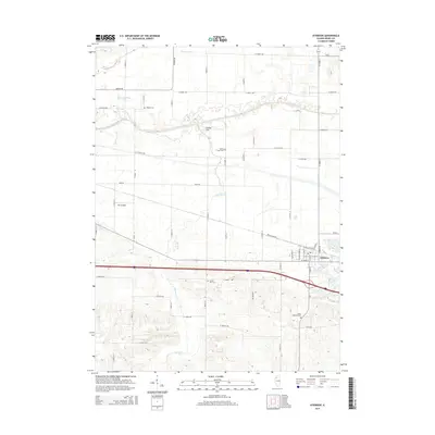
2015 Map of Atkinson
USGS Topo · Published 2015About this map
Atkinson serves as the primary hub of this Henry County landscape, where the town's residential grid meets the major regional thoroughfare of Interstate 80. The surrounding agricultural terrain is defined by a sophisticated drainage network, including the engineered Blue Joint Ditch and the winding course of the Green River. Significant local landmarks such as Indian Hill rise above the flatlands, while the Gen-Airpark indicates the area's modern infrastructure. For those researching family history, the map provides precise locations for several burial grounds, including Saint Anthony Cem near the town center and more rural sites like Mizpah Cem and Spring Creek Cem. The transition from historic routes like Rock Island Rd to modern township roads illustrates the evolution of Henry County's transportation and land use through the early 21st century.
Find a feature on this map
55 named features on this map. Tap any name to fly to it.
Don’t see what you’re looking for? This feature index may not catch every label — zoom into the map to look around manually.
Map Details
Editions of this 2015 Atkinson Map
This is the sole edition of this map. No revisions or reprints were ever made.
Other maps of this area

1899 · Clinton
USGS Topo · 1:125,000

1929 · Annawan
USGS Topo · 1:62,500

1932 · Prophetstown
USGS Topo · 1:48,000

1932 · Annawan
USGS Topo · 1:62,500

1934 · Geneseo
USGS Topo · 1:62,500

1936 · Prophetstown
USGS Topo · 1:62,500

1952 · Erie
USGS Topo · 1:62,500

1953 · German Corner
USGS Topo · 1:24,000
1953 · Geneseo
USGS Topo · 1:24,000
1953 · Cambridge
USGS Topo · 1:24,000