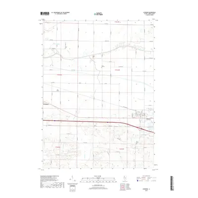
2018 Map of Atkinson
USGS Topo · Published 2018About this map
The agrarian landscape of Henry County is defined by the east-west flow of the Green River and the engineered drainage of the Blue Joint Ditch. This 2018 survey centers on the village of Atkinson, showing the grid of rural roads and interstate infrastructure that connects the community to the nearby city of Geneseo. The map provides significant detail for family historians, documenting several local burial grounds including Mizpah Cem, Spring Creek Cem, and Saint Anthony Cem. North of the river, Indian Hill rises above the alluvial plain, while Spring Creek meanders through the southern sections. Transportation and utility are highlighted by the presence of Gen-Airpark and a dense network of county roads like Rock Island Road, reflecting the continued importance of both traditional agriculture and modern logistics in this portion of Illinois.
Find a feature on this map
62 named features on this map. Tap any name to fly to it.
Don’t see what you’re looking for? This feature index may not catch every label — zoom into the map to look around manually.
Map Details
Editions of this 2018 Atkinson Map
This is the sole edition of this map. No revisions or reprints were ever made.
Other maps of this area

1899 · Clinton
USGS Topo · 1:125,000

1929 · Annawan
USGS Topo · 1:62,500

1932 · Prophetstown
USGS Topo · 1:48,000

1932 · Annawan
USGS Topo · 1:62,500

1934 · Geneseo
USGS Topo · 1:62,500

1936 · Prophetstown
USGS Topo · 1:62,500

1952 · Erie
USGS Topo · 1:62,500

1953 · German Corner
USGS Topo · 1:24,000
1953 · Geneseo
USGS Topo · 1:24,000
1953 · Cambridge
USGS Topo · 1:24,000