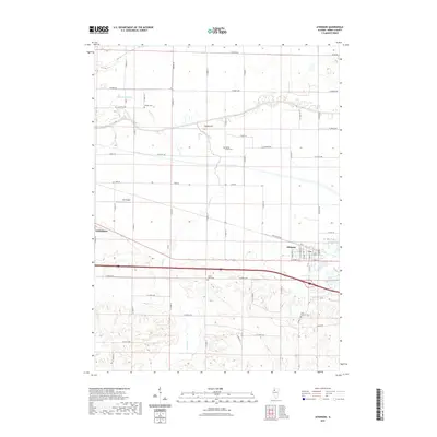
2021 Map of Atkinson
USGS Topo · Published 2021About this map
Atkinson serves as a focal point in this eastern Henry County landscape, where the flat agricultural plains meet the meandering path of the Green River. The region is defined by a dense grid of rural corridors like N 2400th Ave and Atkinson Rd, which connect scattered homesteads and local infrastructure. Genealogists will find several notable burial sites throughout the township, including Mizpah Cem, Spring Creek Cem, Grand View Cem, and Saint Anthony Cem. To the west, the outskirts of Geneseo appear, alongside the Gen-Airpark, reflecting the integration of modern transportation within a traditional farming area. Water management is evident through features like the Blue Joint Ditch and the winding Spring Cr, which help drain the low-lying fields surrounding Indian Hill.
Find a feature on this map
56 named features on this map. Tap any name to fly to it.
Don’t see what you’re looking for? This feature index may not catch every label — zoom into the map to look around manually.
Map Details
Editions of this 2021 Atkinson Map
This is the sole edition of this map. No revisions or reprints were ever made.
Other maps of this area

1899 · Clinton
USGS Topo · 1:125,000

1929 · Annawan
USGS Topo · 1:62,500

1932 · Prophetstown
USGS Topo · 1:48,000

1932 · Annawan
USGS Topo · 1:62,500

1934 · Geneseo
USGS Topo · 1:62,500

1936 · Prophetstown
USGS Topo · 1:62,500

1952 · Erie
USGS Topo · 1:62,500

1953 · German Corner
USGS Topo · 1:24,000
1953 · Geneseo
USGS Topo · 1:24,000
1953 · Cambridge
USGS Topo · 1:24,000