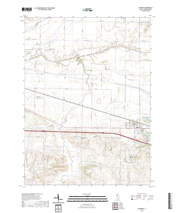
2024 Map of Atkinson
USGS Topo · Published 2024About this map
Atkinson serves as the primary hub of this Henry County landscape, where the grain-and-rail economy is still visible in the town's compact grid and the path of the Rock Island Rd. To the north, the Green River and Blue Joint Ditch cut through the prairie, defining a network of agricultural drainage and family-farm tracts. The map reveals a dense layering of local history through its preservation of several rural burial grounds, including Mizpah Cem, Spring Creek Cem, Grand View Cem, and Saint Anthony Cem. The terrain shifts from the level river bottoms toward the higher ground of Indian Hill in the south, while modern aviation is represented by the Gen-Airpark landing strip. This survey provides a precise account of the rural road network, linking historic creek crossings like those of Spring Creek with the arterial connections of the Interstate and local county highways.
Find a feature on this map
55 named features on this map. Tap any name to fly to it.
Don’t see what you’re looking for? This feature index may not catch every label — zoom into the map to look around manually.
Map Details
Editions of this 2024 Atkinson Map
This is the sole edition of this map. No revisions or reprints were ever made.
Other maps of this area

1899 · Clinton
USGS Topo · 1:125,000

1929 · Annawan
USGS Topo · 1:62,500

1932 · Prophetstown
USGS Topo · 1:48,000

1932 · Annawan
USGS Topo · 1:62,500

1934 · Geneseo
USGS Topo · 1:62,500

1936 · Prophetstown
USGS Topo · 1:62,500

1952 · Erie
USGS Topo · 1:62,500

1953 · German Corner
USGS Topo · 1:24,000
1953 · Geneseo
USGS Topo · 1:24,000
1953 · Cambridge
USGS Topo · 1:24,000