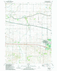
1991 Map of Atkinson
USGS Topo · Published 1992About this map
Agricultural lands and water management projects define this portion of Henry County, anchored by the village of Atkinson. The landscape is intricately partitioned by drainage works including Big Slough Ditch and Blue Joint Ditch, which feed into the Green River. A significant corridor of recreation and transit is found along the Hennepin Canal, bordered by the Hennepin Canal Parkway State Park, showcasing the late 20th-century transition of industrial waterways into protected public spaces.
Find a feature on this map
24 named features on this map. Tap any name to fly to it.
Don’t see what you’re looking for? This feature index may not catch every label — zoom into the map to look around manually.
Map Details
Editions of this 1991 Atkinson Map
This is the sole edition of this map. No revisions or reprints were ever made.
Other maps of this area

1899 · Clinton
USGS Topo · 1:125,000

1929 · Annawan
USGS Topo · 1:62,500

1932 · Prophetstown
USGS Topo · 1:48,000

1932 · Annawan
USGS Topo · 1:62,500

1934 · Geneseo
USGS Topo · 1:62,500

1936 · Prophetstown
USGS Topo · 1:62,500

1952 · Erie
USGS Topo · 1:62,500

1953 · German Corner
USGS Topo · 1:24,000
1953 · Geneseo
USGS Topo · 1:24,000
1953 · Cambridge
USGS Topo · 1:24,000