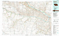
1986 Map of Atkinson
USGS Topo · Published 1988About this map
The Niobrara River carves a deep valley through the northern Nebraska borderlands, where the Yankton Indian Reservation meets the plains. This landscape is defined by the convergence of major waterways, including the Missouri River and the Keya Paha River, creating a network of bottoms and islands such as Sunshine Bottom and Pishelville Island. Small rural settlements like Monowi, Verdigre, and Atkinson are scattered across the terrain, connected by a web of local roads that follow the section lines of the surrounding ranchland. Higher ground is marked by features like the Harvey Buttes and Stony Butte, offering relief from the winding creek valleys. Near the eastern edge, Niobrara State Park sits at the confluence of the Niobrara and Missouri, a significant geographical anchor in a region otherwise characterized by isolated post offices and small farming communities like Pishelville and Venus.
Find a feature on this map
70 named features on this map. Tap any name to fly to it.
Don’t see what you’re looking for? This feature index may not catch every label — zoom into the map to look around manually.
Map Details
Editions of this 1986 Atkinson Map
2 editions found
Other maps of this area

1898 · Olivet
USGS Topo · 1:125,000

1950 · Niobrara
USGS Topo · 1:24,000

1950 · Verdel
USGS Topo · 1:24,000

1950 · Verdigre NE
USGS Topo · 1:24,000

1950 · Dorsey NW
USGS Topo · 1:24,000

1950 · Lynch
USGS Topo · 1:24,000

1950 · Pishelville
USGS Topo · 1:24,000

1950 · Monowi
USGS Topo · 1:24,000

1951 · Butte NW
USGS Topo · 1:24,000

1951 · Bristow
USGS Topo · 1:24,000