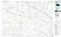
1986 Map of Atkinson
USGS Topo · Published 1986About this map
The confluence of the Niobrara River and Missouri River defines the landscape of the Nebraska-South Dakota borderlands in the mid-1980s. This survey details the transition from the Yankton Indian Reservation in the north to the farming townships of Boyd and Holt counties. Small river towns and rural communities like Lynch, Verdigre, and Bristow are connected by a network of local roads, while the south is anchored by the settlement at Atkinson and the tracks of the Chicago and North Western railroad. Unique topographic features such as Old Baldy, Harvey Buttes, and the Sunshine Bottom floodplain reflect the area's complex river valley geography. Farther south, the grid of townships like Pleasant View and Willowdale illustrates the systematic agricultural development of the region, while an Old Military Reservation Bdy serves as a reminder of earlier frontier administrative divisions.
Find a feature on this map
113 named features on this map. Tap any name to fly to it.
Don’t see what you’re looking for? This feature index may not catch every label — zoom into the map to look around manually.
Map Details
Editions of this 1986 Atkinson Map
2 editions found
Other maps of this area

1898 · Olivet
USGS Topo · 1:125,000

1950 · Niobrara
USGS Topo · 1:24,000

1950 · Verdel
USGS Topo · 1:24,000

1950 · Verdigre NE
USGS Topo · 1:24,000

1950 · Dorsey NW
USGS Topo · 1:24,000

1950 · Lynch
USGS Topo · 1:24,000

1950 · Pishelville
USGS Topo · 1:24,000

1950 · Monowi
USGS Topo · 1:24,000

1951 · Butte NW
USGS Topo · 1:24,000

1951 · Bristow
USGS Topo · 1:24,000