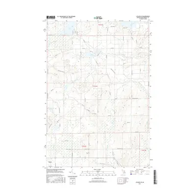
2017 Map of Atlanta SE
USGS Topo · Published 2017About this map
The northern edge of Atlanta anchors this portion of Montmorency County, giving way to a landscape defined by glacial lakes and a complex network of forest trails. Water is the primary geographic feature, from the northern reaches of Rush Lake to the secluded Voyer Lake and Lake Hiawatha. The N Br Thunder Bay River flows through the northwest, while numerous smaller streams like Brush Creek and Miller Creek drain the lowlands. For genealogists, the Avery Cemetery serves as a central point of interest in the southern township. The map reveals the intricate secondary road system that facilitates access to the region's interior, including the Brush Creek Truck Trl and various logging or access paths like Hemak Trl and Coyote Trl, illustrating the area's transition from settlement to managed woodland.
Find a feature on this map
67 named features on this map. Tap any name to fly to it.
Don’t see what you’re looking for? This feature index may not catch every label — zoom into the map to look around manually.
Map Details
Editions of this 2017 Atlanta SE Map
This is the sole edition of this map. No revisions or reprints were ever made.
Other maps of this area

1954 · Traverse City
USGS Topo · 1:250,000

1954 · Tawas City
USGS Topo · 1:250,000

1954 · Alpena
USGS Topo · 1:250,000

1955 · Atlanta
USGS Topo · 1:62,500

1955 · Comins
USGS Topo · 1:62,500

1955 · Hillman
USGS Topo · 1:62,500

1955 · Cheboygan
USGS Topo · 1:250,000

1957 · Alpena
USGS Topo · 1:250,000

1958 · Cheboygan
USGS Topo · 1:250,000

1958 · Traverse City
USGS Topo · 1:250,000