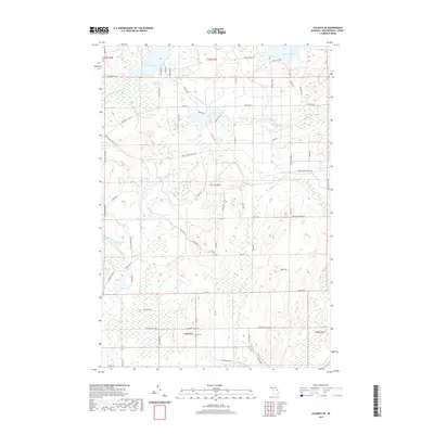
2019 Map of Atlanta SE
USGS Topo · Published 2019About this map
The glacial terrain of Montmorency County is defined here by its intricate network of lakes and cold-water streams. The N Br Thunder Bay River flows through the northwest, while smaller basins like Rush Lake, Grass Lake, and Sportsmen Lake dot the northern and western sections of the quadrangle. In the south, Voyer Lake and the wetlands surrounding Edwards Cr illustrate the low-lying hydrology typical of this part of northern Michigan. Local history and genealogy are anchored by Avery Cem, situated near the intersection of several local routes. The landscape is interconnected by a series of specialized roads and trails, including Scenic Rte 1, Brush Creek Truck Trl, and Argonne Lodge Rd, which navigate the rises and falls of the local topography.
Find a feature on this map
67 named features on this map. Tap any name to fly to it.
Don’t see what you’re looking for? This feature index may not catch every label — zoom into the map to look around manually.
Map Details
Editions of this 2019 Atlanta SE Map
This is the sole edition of this map. No revisions or reprints were ever made.
Other maps of this area

1954 · Traverse City
USGS Topo · 1:250,000

1954 · Tawas City
USGS Topo · 1:250,000

1954 · Alpena
USGS Topo · 1:250,000

1955 · Atlanta
USGS Topo · 1:62,500

1955 · Comins
USGS Topo · 1:62,500

1955 · Hillman
USGS Topo · 1:62,500

1955 · Cheboygan
USGS Topo · 1:250,000

1957 · Alpena
USGS Topo · 1:250,000

1958 · Cheboygan
USGS Topo · 1:250,000

1958 · Traverse City
USGS Topo · 1:250,000