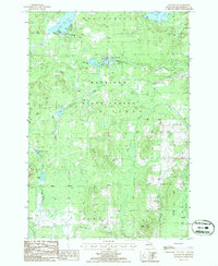
1986 Map of Atlanta SE
USGS Topo · Published 1986About this map
Mackinaw State Forest blankets the landscape of southeastern Montmorency County in this mid-1980s topographic record. The map reveals a region defined by its water and conservation history, featuring numerous water bodies such as Rush Lake, Lake Hiawatha, and the winding Thunder Bay River at the southern edge. The distribution of small lakes like Sportsmen Lake and Voyer Lake suggests a territory geared toward outdoor recreation and timber management.
Find a feature on this map
19 named features on this map. Tap any name to fly to it.
Don’t see what you’re looking for? This feature index may not catch every label — zoom into the map to look around manually.
Map Details
Editions of this 1986 Atlanta SE Map
This is the sole edition of this map. No revisions or reprints were ever made.
Other maps of this area

1954 · Traverse City
USGS Topo · 1:250,000

1954 · Tawas City
USGS Topo · 1:250,000

1954 · Alpena
USGS Topo · 1:250,000

1955 · Atlanta
USGS Topo · 1:62,500

1955 · Comins
USGS Topo · 1:62,500

1955 · Hillman
USGS Topo · 1:62,500

1955 · Cheboygan
USGS Topo · 1:250,000

1957 · Alpena
USGS Topo · 1:250,000

1958 · Cheboygan
USGS Topo · 1:250,000

1958 · Traverse City
USGS Topo · 1:250,000