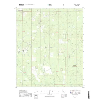
2018 Map of Atlanta
USGS Topo · Published 2018About this map
Atlanta and the surrounding pine-dominated landscapes of Winn Parish are documented here within the Kisatchie National Forest boundaries. The settlement pattern follows a network of local roads such as School House Rd and Old Alexandria Rd, connecting small communities like Five Forks to the larger township. Water dominates the geography, with complex drainage systems including Port de Luce Cr, Hurricane Cr, and Jatt Cr carving through the terrain. Evidence of local history is found in the Swindelly Cem and Antioch Cem, which serve as quiet markers of the area's rural heritage. The presence of Old Mill Pond near the town center suggests a legacy of local industry, while the modern Paxton-Alexandria Pkwy provides a major transport artery through the eastern portion of the quadrangle.
Find a feature on this map
82 named features on this map. Tap any name to fly to it.
Don’t see what you’re looking for? This feature index may not catch every label — zoom into the map to look around manually.
Map Details
Editions of this 2018 Atlanta Map
This is the sole edition of this map. No revisions or reprints were ever made.
Other maps of this area

1932 · Colfax NE
USGS Topo · 1:31,680

1932 · Colfax NW
USGS Topo · 1:31,680

1935 · Verda
USGS Topo · 1:31,680

1936 · Colfax
USGS Topo · 1:62,500

1937 · Montgomery
USGS Topo · 1:62,500

1942 · Montgomery
USGS Topo · 1:62,500

1945 · Montgomery
USGS Topo · 1:62,500

1949 · Calvin SE
USGS Topo · 1:31,680

1949 · Calvin NE
USGS Topo · 1:31,680

1950 · Winnfield
USGS Topo · 1:62,500