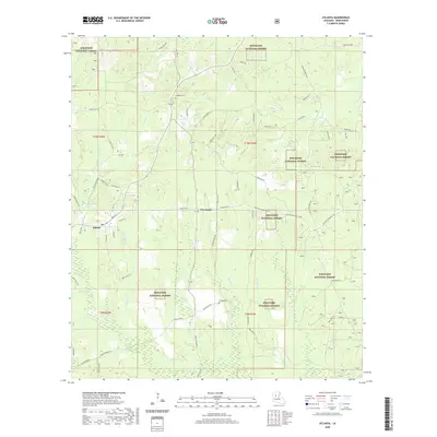
2020 Map of Atlanta
USGS Topo · Published 2020About this map
Atlanta sits at the intersection of local routes in western Winn Parish, serving as the primary settlement in a landscape defined by the expansive Kisatchie National Forest. This modern survey reveals a community structure tied to historic parish roads and names like School Rd and Main St. The terrain is etched by an intricate drainage system including Hill Bayou, Iatt Cr, and Port de Luce Cr, suggesting the hydrology that shaped early land use. Local history and genealogy are anchored by specific landmarks such as Antioch Cem and Swindelly Cem. To the northwest of the town center, Old Mill Pond hints at earlier industrial activity on the creek. The small settlement of Five Forks further illustrates the dispersed residential pattern typical of this timber-rich region of central Louisiana.
Find a feature on this map
78 named features on this map. Tap any name to fly to it.
Don’t see what you’re looking for? This feature index may not catch every label — zoom into the map to look around manually.
Map Details
Editions of this 2020 Atlanta Map
This is the sole edition of this map. No revisions or reprints were ever made.
Other maps of this area

1932 · Colfax NE
USGS Topo · 1:31,680

1932 · Colfax NW
USGS Topo · 1:31,680

1935 · Verda
USGS Topo · 1:31,680

1936 · Colfax
USGS Topo · 1:62,500

1937 · Montgomery
USGS Topo · 1:62,500

1942 · Montgomery
USGS Topo · 1:62,500

1945 · Montgomery
USGS Topo · 1:62,500

1949 · Calvin SE
USGS Topo · 1:31,680

1949 · Calvin NE
USGS Topo · 1:31,680

1950 · Winnfield
USGS Topo · 1:62,500