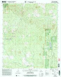
2003 Map of Atlanta
USGS Topo · Published 2005About this map
Atlanta serves as the primary hub of this northern Louisiana landscape, surrounded by the mixed timberland and creek bottoms of the Kisatchie National Forest. The map illustrates a rural economy historically tied to the land, evidenced by multiple Gravel Pits and the Old Mill Pond. To the west of the settlement, a Lookout Tower stands near Sardis, providing a high-ground vantage over the dense forest canopy.
Find a feature on this map
34 named features on this map. Tap any name to fly to it.
Don’t see what you’re looking for? This feature index may not catch every label — zoom into the map to look around manually.
Map Details
Editions of this 2003 Atlanta Map
This is the sole edition of this map. No revisions or reprints were ever made.
Other maps of this area

1932 · Colfax NE
USGS Topo · 1:31,680

1932 · Colfax NW
USGS Topo · 1:31,680

1935 · Verda
USGS Topo · 1:31,680

1936 · Colfax
USGS Topo · 1:62,500

1937 · Montgomery
USGS Topo · 1:62,500

1942 · Montgomery
USGS Topo · 1:62,500

1945 · Montgomery
USGS Topo · 1:62,500

1949 · Calvin SE
USGS Topo · 1:31,680

1949 · Calvin NE
USGS Topo · 1:31,680

1950 · Winnfield
USGS Topo · 1:62,500