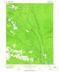
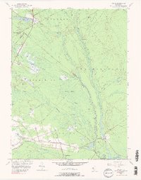
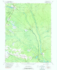
1953 Map of Atsion
USGS Topo · Published 1963About this map
Cranberry cultivation and the complex hydrology of the Pine Barrens dominate this 1953 landscape. The confluence of the Mullica River and Batsto River anchors the southern portion of the sheet, where historic iron-working and milling sites like Batsto and Pleasant Mills are located. Numerous Cranberry Bogs are carved into the low-lying terrain of the Great Swamp, particularly along the Sleeper Branch and Albertson Brook. This industry shaped the settlement patterns of the mid-20th century, with clusters of activity at Atsion and Nesco.
Find a feature on this map
70 named features on this map. Tap any name to fly to it.
Don’t see what you’re looking for? This feature index may not catch every label — zoom into the map to look around manually.
Map Details
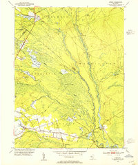
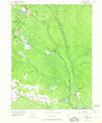
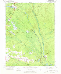
Editions of this 1953 Atsion Map
6 editions found
Other maps of this area

1888 · Pemberton
USGS Topo · 1:62,500

1888 · Mount Holly
USGS Topo · 1:62,500

1890 · Hammonton
USGS Topo · 1:62,500

1890 · Mullica
USGS Topo · 1:62,500

1894 · Hammonton
USGS Topo · 1:62,500

1894 · Pemberton
USGS Topo · 1:62,500

1894 · Mount Holly
USGS Topo · 1:62,500

1894 · Mullica
USGS Topo · 1:62,500

1898 · Pemberton
USGS Topo · 1:62,500

1898 · Mount Holly
USGS Topo · 1:62,500
Featured Places
- Hammonton, NJ
- Tabernacle Township, NJ
- Mullica Township, NJ
- Washington Township, NJ
- Waterford Township, NJ