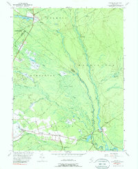
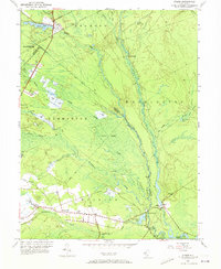
1953 Map of Atsion
USGS Topo · Published 1989About this map
Atsion and the surrounding Pine Barrens are defined by an intricate network of waterways and the specialized agriculture of the mid-20th century. The landscape is dominated by the Batsto River and the Mullica River, which supported early industries at Batsto and Pleasant Mills. Numerous Cranberry Bogs are scattered throughout the lowlands, particularly along the Sleeper Branch, illustrating the region's long-standing reliance on peatland cultivation. Further south, the settlements of Nesco and Wescoatville appear alongside more traditional infrastructure such as the Nesco Sch. The presence of landmarks like Quaker Bridge and Lower Forge hints at the historic iron-making and transit routes that once connected these wilderness outposts. This detailed survey preserves the spatial layout of the Great Swamp and its conversion into productive berry lands before modern preservation efforts took hold.
Find a feature on this map
50 named features on this map. Tap any name to fly to it.
Don’t see what you’re looking for? This feature index may not catch every label — zoom into the map to look around manually.
Map Details
Editions of this 1953 Atsion Map
6 editions found
Other maps of this area

1888 · Pemberton
USGS Topo · 1:62,500

1888 · Mount Holly
USGS Topo · 1:62,500

1890 · Hammonton
USGS Topo · 1:62,500

1890 · Mullica
USGS Topo · 1:62,500

1894 · Hammonton
USGS Topo · 1:62,500

1894 · Pemberton
USGS Topo · 1:62,500

1894 · Mount Holly
USGS Topo · 1:62,500

1894 · Mullica
USGS Topo · 1:62,500

1898 · Pemberton
USGS Topo · 1:62,500

1898 · Mount Holly
USGS Topo · 1:62,500
Featured Places
- Hammonton, NJ
- Tabernacle Township, NJ
- Mullica Township, NJ
- Washington Township, NJ
- Waterford Township, NJ