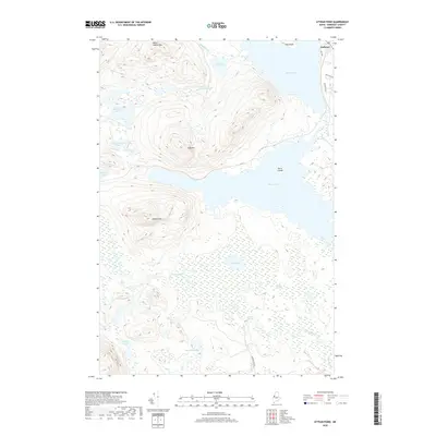
2018 Map of Attean Pond
USGS Topo · Published 2018About this map
Jackman serves as the primary settlement hub in this part of Somerset County, where the developed corridor of Big Wood Dr and Deer Run Dr meets the southern shore of Wood Pond. The landscape is dominated by a complex network of waterways and peaks, including Sally Mtn and Attean Mtn, which frame the large, island-dotted expanse of Attean Pond. To the south, the terrain transitions into the extensive Number Five Bog and the meandering path of the Moose River, where Holeb Falls marks a distinct point on the river's course.
Find a feature on this map
27 named features on this map. Tap any name to fly to it.
Don’t see what you’re looking for? This feature index may not catch every label — zoom into the map to look around manually.
Map Details
Editions of this 2018 Attean Pond Map
This is the sole edition of this map. No revisions or reprints were ever made.
Other maps of this area

1922 · Long Pond
USGS Topo · 1:62,500

1923 · Attean
USGS Topo · 1:62,500

1924 · Long Pond
USGS Topo · 1:62,500

1925 · Pierce Pond
USGS Topo · 1:48,000

1925 · Attean
USGS Topo · 1:62,500

1927 · Pierce Pond
USGS Topo · 1:62,500

1928 · Spencer
USGS Topo · 1:48,000

1932 · Spencer
USGS Topo · 1:62,500

1944 · Long Pond
USGS Topo · 1:62,500

1944 · Pierce Pond
USGS Topo · 1:62,500