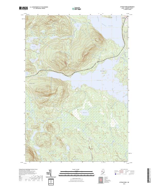
2024 Map of Attean Pond
USGS Topo · Published 2024About this map
Jackman serves as the gateway to this wilderness region of Somerset County, where the Moose River carves a path through a series of significant water bodies and rugged peaks. The landscape is dominated by the massive Attean Pond and its neighbor Wood Pond, separated by prominent islands like Birch Island and Hog Island. To the west, the terrain rises sharply toward Burnt Jacket Mtn and Sally Mtn, framing a network of smaller glacial basins including Clearwater Pond, Long Pond, and Horseshoe Pond.
Find a feature on this map
34 named features on this map. Tap any name to fly to it.
Don’t see what you’re looking for? This feature index may not catch every label — zoom into the map to look around manually.
Map Details
Editions of this 2024 Attean Pond Map
This is the sole edition of this map. No revisions or reprints were ever made.
Other maps of this area

1922 · Long Pond
USGS Topo · 1:62,500

1923 · Attean
USGS Topo · 1:62,500

1924 · Long Pond
USGS Topo · 1:62,500

1925 · Pierce Pond
USGS Topo · 1:48,000

1925 · Attean
USGS Topo · 1:62,500

1927 · Pierce Pond
USGS Topo · 1:62,500

1928 · Spencer
USGS Topo · 1:48,000

1932 · Spencer
USGS Topo · 1:62,500

1944 · Long Pond
USGS Topo · 1:62,500

1944 · Pierce Pond
USGS Topo · 1:62,500