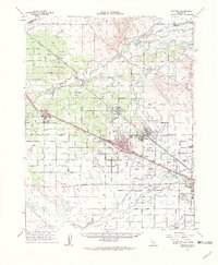
1961 Map of Atwater
USGS Topo · Published 1963About this map
Castle Air Force Base dominates the eastern landscape of this early 1960s Central Valley survey, reflecting the era's significant military footprint in Merced County. The region's agricultural and industrial infrastructure is clearly defined by the parallel routes of the Atchison Topeka and Santa Fe Railroad and the Southern Pacific Railroad, which link established centers like Atwater, Livingston, and Winton. North of the Merced River, smaller settlements such as Amsterdam and Hopeton appear alongside the intricate network of the Ingalsbe Slough and Hopeton Slough. The presence of the County Honor Farm and the Winton Cem provides specific points of interest for local historians, while the Mc Connell State Park along the river highlights early recreational development in a landscape heavily shaped by irrigation canals and gravel pits.
Find a feature on this map
85 named features on this map. Tap any name to fly to it.
Don’t see what you’re looking for? This feature index may not catch every label — zoom into the map to look around manually.
Map Details
Editions of this 1961 Atwater Map
2 editions found
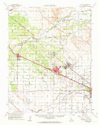
Other maps of this area

1893 · Sonora
USGS Topo · 1:125,000

1896 · Sonora
USGS Topo · 1:125,000

1897 · Sonora
USGS Topo · 1:125,000

1898 · Sonora
USGS Topo · 1:125,000

1913 · Dickenson
USGS Topo · 1:31,680

1914 · Merced
USGS Topo · 1:31,680

1916 · Three Tree Flat
USGS Topo · 1:31,680

1916 · Hopeton
USGS Topo · 1:31,680

1916 · Cressey
USGS Topo · 1:31,680

1916 · Montpellier
USGS Topo · 1:31,680