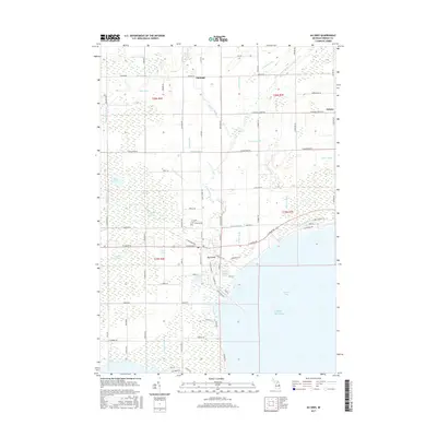
2017 Map of Au Gres
USGS Topo · Published 2017About this map
Au Gres serves as the focal point of this coastal landscape where the Au Gres River meets the expansive Saginaw Bay of Lake Huron. The drainage patterns across Arenac County are highly developed, featuring a dense network of managed waterways like the Hemingway Drain, Cedar Cr Drain, and Bum Drain. These systems reflect a long history of water management to support the low-lying agricultural lands surrounding the settlements of Santiago and Delano. Near the center of the quadrangle, Linwood Cem stands along Linwood Rd, providing a specific point of interest for those tracing local family histories. The presence of the Au Gres Swamp and Duck Lake Swamp illustrates the naturally marshy character of the thumb region's coastline, even as modern roads like E Huron Rd and Mackinaw Rd define the contemporary travel corridors.
Find a feature on this map
95 named features on this map. Tap any name to fly to it.
Don’t see what you’re looking for? This feature index may not catch every label — zoom into the map to look around manually.
Map Details
Editions of this 2017 Au Gres Map
This is the sole edition of this map. No revisions or reprints were ever made.
Other maps of this area

1954 · Flint
USGS Topo · 1:250,000

1954 · Tawas City
USGS Topo · 1:250,000

1958 · Flint
USGS Topo · 1:250,000

1958 · Tawas City
USGS Topo · 1:250,000

1966 · Point Lookout
USGS Topo · 1:24,000

1966 · Au Gres
USGS Topo · 1:24,000

1966 · Alabaster
USGS Topo · 1:24,000

1966 · National City
USGS Topo · 1:24,000
1967 · Standish NE
USGS Topo · 1:24,000

1968 · Whittemore
USGS Topo · 1:24,000