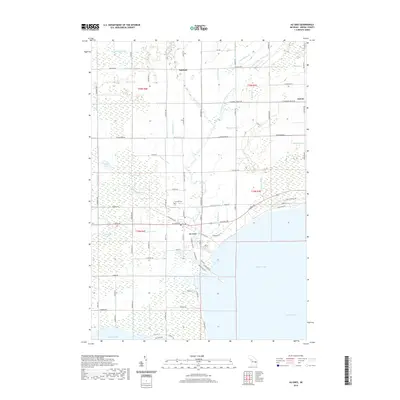
2019 Map of Au Gres
USGS Topo · Published 2019About this map
The city of Au Gres serves as the central hub of this Arenac County landscape, situated where the Au Gres River meets the expansive waters of Saginaw Bay on Lake Huron. The surrounding terrain is defined by complex drainage systems and lowlands, notably the Au Gres Swamp and Duck Lake Swamp. Smaller settlements like Santiago and Delano are connected by a grid of rural roads, many of which follow section lines established by the Public Land Survey System. The presence of Linwood Cem near Duck Lake and the various man-made watercourses, such as the Hemenway Drain and Mattison Drain, illustrate the long-term engineering required to manage this coastal environment for agriculture and habitation. The map reveals the distinct transition from the forested wetlands of the interior to the developed shoreline along W Taral Terrace Dr and other lakeside residential corridors.
Find a feature on this map
98 named features on this map. Tap any name to fly to it.
Don’t see what you’re looking for? This feature index may not catch every label — zoom into the map to look around manually.
Map Details
Editions of this 2019 Au Gres Map
This is the sole edition of this map. No revisions or reprints were ever made.
Other maps of this area

1954 · Flint
USGS Topo · 1:250,000

1954 · Tawas City
USGS Topo · 1:250,000

1958 · Flint
USGS Topo · 1:250,000

1958 · Tawas City
USGS Topo · 1:250,000

1966 · Point Lookout
USGS Topo · 1:24,000

1966 · Au Gres
USGS Topo · 1:24,000

1966 · Alabaster
USGS Topo · 1:24,000

1966 · National City
USGS Topo · 1:24,000
1967 · Standish NE
USGS Topo · 1:24,000

1968 · Whittemore
USGS Topo · 1:24,000