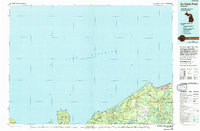
1984 Map of Au Sable Point
USGS Topo · Published 1994About this map
Pictured Rocks National Lakeshore dominates this coastal survey, preserving a dramatic stretch of Lake Superior shoreline in Alger County. The map details the complex geography of Grand Island, including the sheltered waters of Trout Bay and prominent landforms like North Point and Northeast Point. Further east along the coast, the landscape transitions from the sheer cliffs near Grand Portal Point and Spray Falls to the expansive Grand Sable Dunes near the township of Burt.
Find a feature on this map
48 named features on this map. Tap any name to fly to it.
Don’t see what you’re looking for? This feature index may not catch every label — zoom into the map to look around manually.
Map Details
Editions of this 1984 Au Sable Point Map
2 editions found
Other maps of this area

1931 · Seney NW
USGS Topo · 1:31,680

1931 · Driggs Lake NE
USGS Topo · 1:31,680

1931 · Shingleton NE
USGS Topo · 1:31,680

1931 · Driggs Lake NW
USGS Topo · 1:31,680

1932 · Skandia NE
USGS Topo · 1:31,680

1954 · Sault Sainte Marie
USGS Topo · 1:250,000

1956 · Sault Sainte Marie
USGS Topo · 1:250,000

1957 · Sault Sainte Marie
USGS Topo · 1:250,000

1958 · Sault Sainte Marie
USGS Topo · 1:250,000

1958 · Munising
USGS Topo · 1:62,500
Featured Places
- Au Train Township, MI
- Munising Township, MI
- Grand Island Township, MI
- Onota Township, MI
- Burt Township, MI