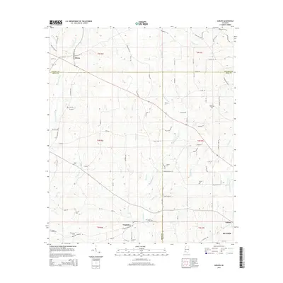
2015 Map of Auburn
USGS Topo · Published 2015About this map
Auburn serves as a central point of reference in this corner of southwest Mississippi, where the borders of Amite, Lincoln, and Pike Counties converge. The landscape is defined by the headwaters and tributaries of several major regional river systems, most notably the south-flowing Tangipahoa River and the E Fork Amite River. The rural character of the area is underscored by an extensive network of family-named roads and numerous small burial grounds, such as Tangipahoa Cem and Johnson Chapel Cem, which offer significant value for genealogical research. The terrain consists of rolling hills dissected by numerous creeks, including Gordon Cr, McGehee Cr, and Haymans Cr. Toward the southeast, the map shows the transition into the outskirts of McComb, reflecting the gradual shift from the heavily wooded and agricultural river forks toward the more developed corridors of Pike County.
Find a feature on this map
91 named features on this map. Tap any name to fly to it.
Don’t see what you’re looking for? This feature index may not catch every label — zoom into the map to look around manually.
Map Details
Editions of this 2015 Auburn Map
This is the sole edition of this map. No revisions or reprints were ever made.
Other maps of this area

1953 · Natchez
USGS Topo · 1:250,000

1956 · Natchez
USGS Topo · 1:250,000

1959 · Natchez
USGS Topo · 1:250,000

1972 · West Lincoln
USGS Topo · 1:24,000

1972 · Smithdale
USGS Topo · 1:24,000

1972 · Little Springs
USGS Topo · 1:24,000

1972 · Auburn
USGS Topo · 1:24,000

1972 · Bogue Chitto
USGS Topo · 1:24,000

1972 · McComb South
USGS Topo · 1:24,000

1972 · Peoria
USGS Topo · 1:24,000