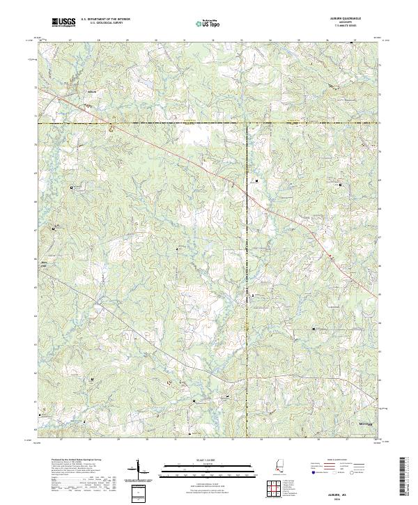
2024 Map of Auburn
USGS Topo · Published 2024About this map
The rolling hills of southwest Mississippi meet at the border of Amite, Lincoln, and Pike Counties, where the headwaters of the East Fork Amite River and the Tangipahoa River begin their southward journey. The small settlement of Auburn serves as a northern anchor for this rural landscape, which is defined by a dense network of family-named roads and remote burial grounds. Genealogy researchers will find significant value in the distribution of family landmarks such as the McGehee Cem, Johnston Chapel Cem, and Whittington Cem. The terrain rises toward Mars Hill in the west, while the southeastern corner touches the outskirts of McComb. Local commerce and community life historically clustered around intersections like Timberline, with small tributaries like Adams Creek and Cobb Branch weaving through the timberlands and farm plots.
Find a feature on this map
98 named features on this map. Tap any name to fly to it.
Don’t see what you’re looking for? This feature index may not catch every label — zoom into the map to look around manually.
Map Details
Editions of this 2024 Auburn Map
This is the sole edition of this map. No revisions or reprints were ever made.
Other maps of this area

1953 · Natchez
USGS Topo · 1:250,000

1956 · Natchez
USGS Topo · 1:250,000

1959 · Natchez
USGS Topo · 1:250,000

1972 · West Lincoln
USGS Topo · 1:24,000

1972 · Smithdale
USGS Topo · 1:24,000

1972 · Little Springs
USGS Topo · 1:24,000

1972 · Auburn
USGS Topo · 1:24,000

1972 · Bogue Chitto
USGS Topo · 1:24,000

1972 · McComb South
USGS Topo · 1:24,000

1972 · Peoria
USGS Topo · 1:24,000