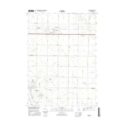
2017 Map of Auburn
USGS Topo · Published 2017About this map
Auburn and Freeland serve as the primary hubs in this agricultural and industrial landscape along the border of Bay and Saginaw Counties. The map reveals a complex water management system vital to the region's drainage, including the Kawkawlin River and several major branches of Squaconning Creek. The expansive MBS International Airport dominates the central terrain, bridging the gap between the residential growth in Freeland and the smaller settlement at Fisherville. Local history is preserved through several family and religious landmarks, including the Saint Anthony Cemetery and Daheim-Kirchof Cemetery. The layout of the region is defined by a rigorous grid of roads like Garfield Road and Hotchkiss Road, while the Tittabawassee River cuts through the southwestern corner, anchoring the community of Freeland to the river's edge.
Find a feature on this map
90 named features on this map. Tap any name to fly to it.
Don’t see what you’re looking for? This feature index may not catch every label — zoom into the map to look around manually.
Map Details
Editions of this 2017 Auburn Map
This is the sole edition of this map. No revisions or reprints were ever made.
Other maps of this area

1916 · Bay City
USGS Topo · 1:62,500

1917 · St. Charles
USGS Topo · 1:62,500

1919 · Bay City
USGS Topo · 1:62,500

1919 · Saginaw
USGS Topo · 1:62,500

1941 · Saginaw
USGS Topo · 1:62,500

1943 · Bay City
USGS Topo · 1:62,500

1943 · Saginaw
USGS Topo · 1:62,500

1943 · St. Charles
USGS Topo · 1:62,500

1954 · Midland
USGS Topo · 1:250,000

1954 · Flint
USGS Topo · 1:250,000